


This article was written regarding work conducted under legacy company names: Continental Mapping, GISinc, or TSG Solutions. These three companies merged in January 2021 to form a new geospatial leader Axim Geospatial.
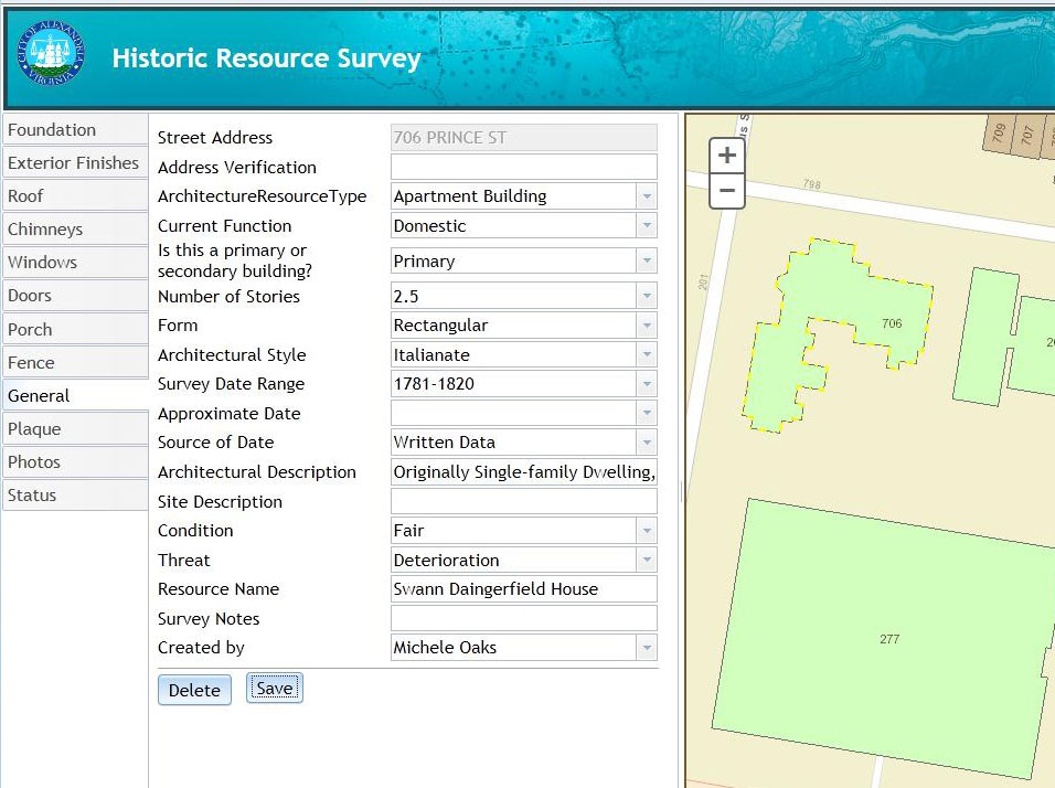
The City of Alexandria, Virginia is working in conjunction with the State of Virginia and the National Park Service to conduct a field survey of historic buildings from the 18th and 19th centuries. They wished to use tablet devices to collect the information while at the physical location rather than the traditional method of taking notes and then entering them back in the office. An application needed to be built to track their location and allow direct data capture of the attributes not only of the overall structure but its individual components such as doors, windows, facades, roofing, and the like. The goal was to collect better data while reducing the amount of time required. To support the application, a database design meeting city, state, and federal level requirements had to be designed.
Axim Geospatial first helped design a database schema to capture both the City's unique desired attributes along with the State and Federal mandated information in a format able to be easily exported to the necessary reports for the partnering agencies. The design is reliant upon core building polygons with a series of related information tables and domains for the various building components. Required to edit information in these tables, the team implemented a custom, secured Javascript application to run on tablet devices and collect information through the electronic forms. The collection workflow was organized in a "foundation-to-roof" manner to make it more intuitive for users. The app indicates the collection status of the structure and ensures that all required attributes are collected. A successful initial pilot project collecting more than 500 buildings has cleared the way for the full collection of the remaining historic structures throughout the City.
A few benefits to the City:
- Field collection directly into the database reduced collection time and prevented entry errors
- Database design allowed for the collection of information for multiple agencies
- Volunteers were able to run the application
- The pilot project cleared the way for the full collection of remaining structures

