


This article was written regarding work conducted under legacy company names: Continental Mapping, GISinc, or TSG Solutions. These three companies merged in January 2021 to form a new geospatial leader Axim Geospatial.
Challenge
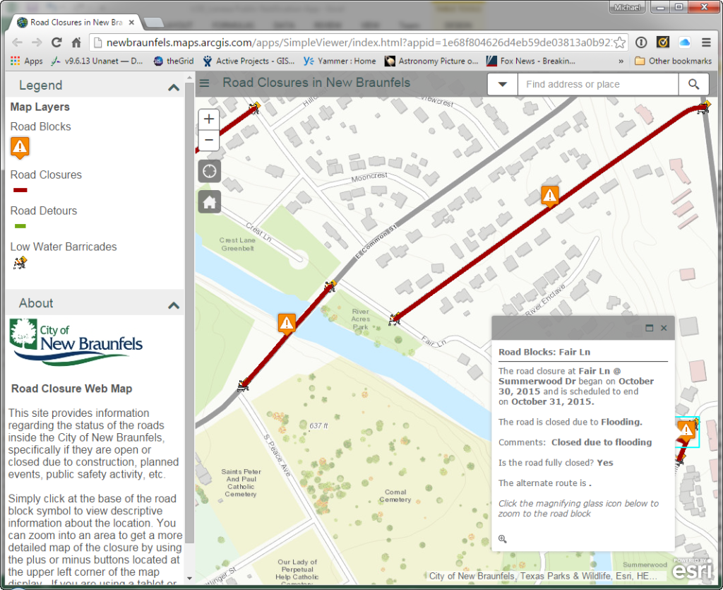
The City of New Braunfels, TX is situated uniquely at the confluence of two rivers, the Guadalupe and Comal, presenting a major flooding threat to the city and its citizens when substantial rainfall occurs. Aside from preparing and mitigating residential loss, the city must address low-water crossings to inform and protect the public when the rivers reach critical mass. The primary objective is to make sure the city can communicate to the public in a timely and efficient manner about dangerous areas to avoid. They needed a technology that not only informs citizens that they must take another route but aims to eliminate deaths resulting from vehicles being swept away by floodwaters.
Solution
With enterprise GIS already in place, we worked with the city’s GIS team to deploy their ArcGIS Road Closures Application, which enabled them to use their own authoritative data, easily update the status of each road crossing, and enabled citizens to access from multiple devices.
The success of the application and lessons learned from the deployment led the team to begin work on a lightweight web application that directly tied in to their GIS data and worked across any mobile device the field crew was using. Crews could quickly log in, identify their areas via a simple-dynamic search, and update the status of the area. This status update, immediately updated the visual representation of what the citizen was seeing using the Road Closures Application.
Business Value
Because the city had already invested in creating, supporting, and maintaining an enterprise GIS solution, we were able to easily and effectively embrace the ArcGIS Road Closures application. Their investment enables the city to continually look for ways to integrate and utilize this enterprise geospatial content in impactful ways to address real business needs throughout the organization. This also affords them the flexibility and agility they demand when responding to emergency events, now and into the future.
This application not only allows citizens to circumvent closed areas, but prevents them from entering areas where environmental circumstances could be potentially fatal.

