Axim Geospatial is now an NV5 company!

Learn More

Geospatial Services That Empower You to Defend & Fight

Few jobs are as critical as defense operations. However, that pressure can lead to significant stress, particularly when you cannot quickly utilize geospatial services and solutions to protect the people who depend on you.

Axim Geospatial empowers agencies to improve operational readiness using location data, so they can gain actionable insight, identify potential risks, and respond to threats swiftly.

Schedule a Meeting

Reduce Risks, Threats, and Stress with Axim Geospatial

Operational readiness can mean the difference between resolving threats fast and making your organization vulnerable to safety and security threats. With how much is on the line, the last thing you should have to worry about is whether your data is accurate, easily accessible, and actionable.

At Axim, we understand how frustrating it can be when you know you could be doing more to fight off threats. We are an Esri Platinum Partner and have supported defense agencies since 2003.

Axim provides geospatial services and solutions that allow you to:

  • Know where your assets are and rapidly access critical information about them
  • Collaborate from the same dashboards as the rest of your team
  • Gain actionable insights to make informed decisions

With Axim, you can do more for the men and women who depend on you while reducing stress and risks. Schedule a meeting with Axim today, and together, we will ensure your team is better informed to defend and fight.

Schedule a MeetingDiscover 6 Crucial Mistakes to Avoid with Operational Dashboards

How We Help

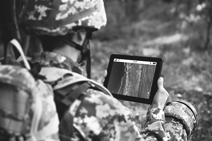
Your job is too important to let outdated technology hold you back. Whatever your mission needs, our team has the expertise to help you bring your vision to life with C4ISR capabilities.

To create your custom solution, Axim works with you to:

  • Gather requirements
  • Architect a solution
  • Implement data and infrastructure components
  • Develop a custom application
  • Configure and deploy the solution to a client environment in adherence to government security requirements

To optimize architecture within your existing environment, you need a strong understanding of the technical, functional, and utilization requirements. This can be incredibly stressful if you don’t have a geospatial partner to guide you through the process.

Our team uses Esri tools and models to help you identify deployment patterns, optimize your system’s performance, and minimize cost. We follow the latest best practices and work within your security constraints to meet your organizational objectives.

You cannot answer the big questions your organization faces without integrating and managing diverse geospatial data sets.

Geospatial data that is organized, enriched with meaningful metadata, and conditioned for operations enables your organization to build the analytic capabilities and addresses your critical mission needs. This allows you to do what you do even better, without the stress and frustrations of messy data.

Our team of geospatial experts have been supporting defense clients for more than 20 years through scalable and affordable data production, data conflation, automated feature extraction, and data quality assessments.

Axim data services empower your platforms through persistent monitoring, data fusion, and data analytics—so you can spend less time stressing about your geospatial solutions and more time focusing on the mission.

Commercial geospatially enabled data has become widely available in recent years, allowing you to support your customer’s mission imperatives while making it even easier to protect our troops. Unfortunately, the access and rights to the data can be complex and don’t always fit into your agency's use cases and mission needs.

Our team’s deep understanding of the FAR, commercial licensing, and customer use cases enables you to fast-track the adoption of your data into an agency’s operation. We will set you up for success with source harvesting, data evaluation, licensing negotiations, terms of service, and data adoption.

Technical deployment and implementation can be stressful. Axim leverages best practices across a broad spectrum of services to support your mission.

We don’t just provide support during the set-up process. We stick around. With our direct support and communication, you will be able to meet your requirements in a timely manner and feel confident knowing your solution will continue to provide benefits for years to come.

When you cannot visualize your data, it is more difficult to make the best decision for the men and women depending on you.

Axim helps with data mapping/ETL (extract/transform/load) integrations, so you can operationalize your data in a location platform. We provide a data-centric review/analysis to identify analytics and provide assistance to support your mission with automated workflows, business intelligence and AI/ML.

Once the data is conditioned, our team supports any type of visualization needs whether Global or Tactical views, Indoor Mapping, or 3D Modeling. We will create maps, data-driven pages, dashboards, or story maps to organize your data and make it clear and appealing.

Your team has the skills to handle most problems. However, as your project evolves and matures, your skills need to grow as well.

Axim provides on-site support for your team to ensure that you will always have the skills you need to achieve your mission. Our comprehensive recruiting process provides you with the right talent and skill sets, when and where you need them. We also support cleared staffing at any security level.

When you need to migrate to the cloud, you want it done correctly the first time. Unfortunately, implementing cloud services requires intensive planning and decision-making to execute correctly. This can be overwhelming when you already have many pressing tasks to take care of.

Let us take the stress off your plate. For over a decade, Axim has offered a variety of cloud management services for customers in the cloud and hybrid environments. We work within our clients’ existing infrastructure and security requirements, no matter how complex.

We help with:

  • Architecture and design
  • Cloud environment setup
  • Implementation and migration
  • Environmental management
  • Server monitoring
  • Software upgrades
  • Ad hoc support

You want accurate, useful, and easy-to-understand cartographic products. What you don’t want is the additional stress of adjusting your map documents to bring your vision for the products to life.

Our trained cartographers balance the science of data with the art of presentation. With more than 20 years of experience building charts and the standards that govern the charts, we can provide you with a proven, high quality, and scalable production model to meet any scale or chart domain.

We create cartographic products that are rich with data but remain easy to read. Our cartography experts condition data to prepare and package dataset inputs for cartographic production.

We use expert analysis to combine multiple sources into a cohesive dataset that incorporates the best of each, so you can instantly gain insights and determine your next steps. To improve efficiencies and the quality of your end product, we always follow clear procedures and make the most out of automation.

Schedule a Meeting

Discover 6 Crucial Mistakes to Avoid with Operational Dashboards

ESRI-partner-network-platinum-logo-intel

ArcGIS-indoors-specialty-logo-intel

esri-arcgis-hub-specialty4x-intel

ESRI-ArcGIS-cloud-services-specialty-logo-intel

3 Steps to Actionable Data & Peace of Mind


Schedule a meeting

Set up a conversation with Axim, and one of our experts will work with you to create a plan to help you solve your defense challenges.

Build the solution

We will design and implement a solution or teach you how to create one yourself. Either way, you will be set up for success.

Empower your organization

With the best geospatial solution in place, you can feel confident knowing you have what you need to achieve your mission and make the best decisions.

Schedule a Meeting

Protect Your Nation. Achieve Your Mission.

Don’t let security threats slip through the cracks. Improve your organizational readiness and fight back with geospatial data intelligence.

Schedule a Meeting