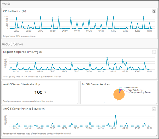
Cara Nolte | November 13, 2023
Optimize GIS with ArcGIS Monitor 2023. Proactive health, performance, and Managed Services support.
Read More
Meg Dobson | October 26, 2023
Meet Axim's Jenny Benish and learn about her journey in GIS.
Read More
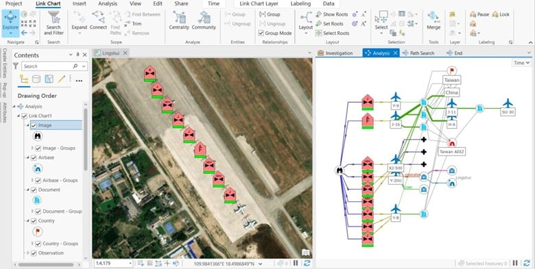
Chancee Vincent | July 7, 2023
Uncover hidden connections with Graph Databases & ArcGIS Knowledge. Explore transformative technology, uncover patterns, and make informed decisions.
Read More
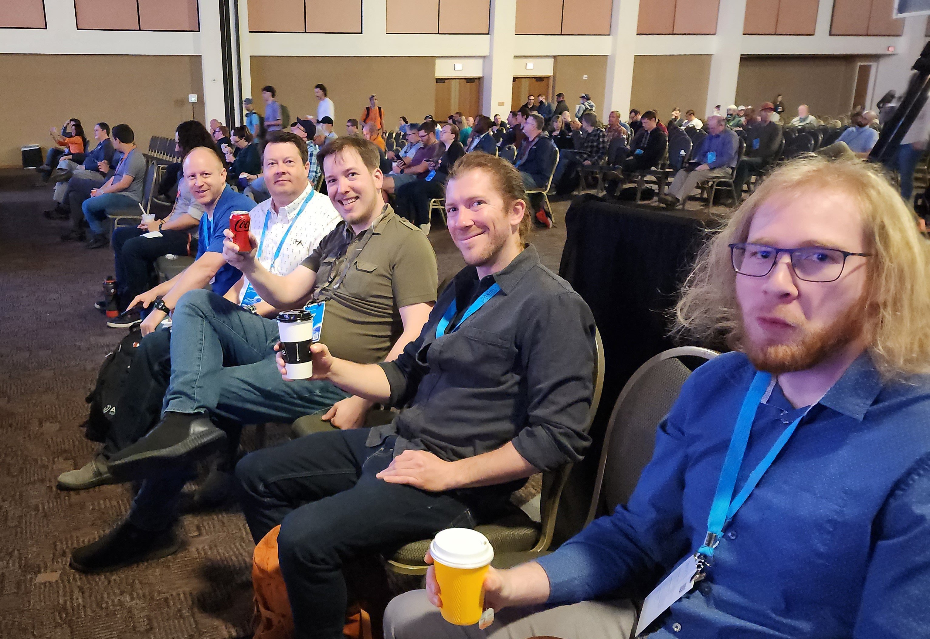
Patrick Murn | July 6, 2023
Explore GEOINT Symposium highlights as Axim Geospatial employees share insights on AI, diverse talent, and commercial services in geospatial intelligence. Join us now!
Read More
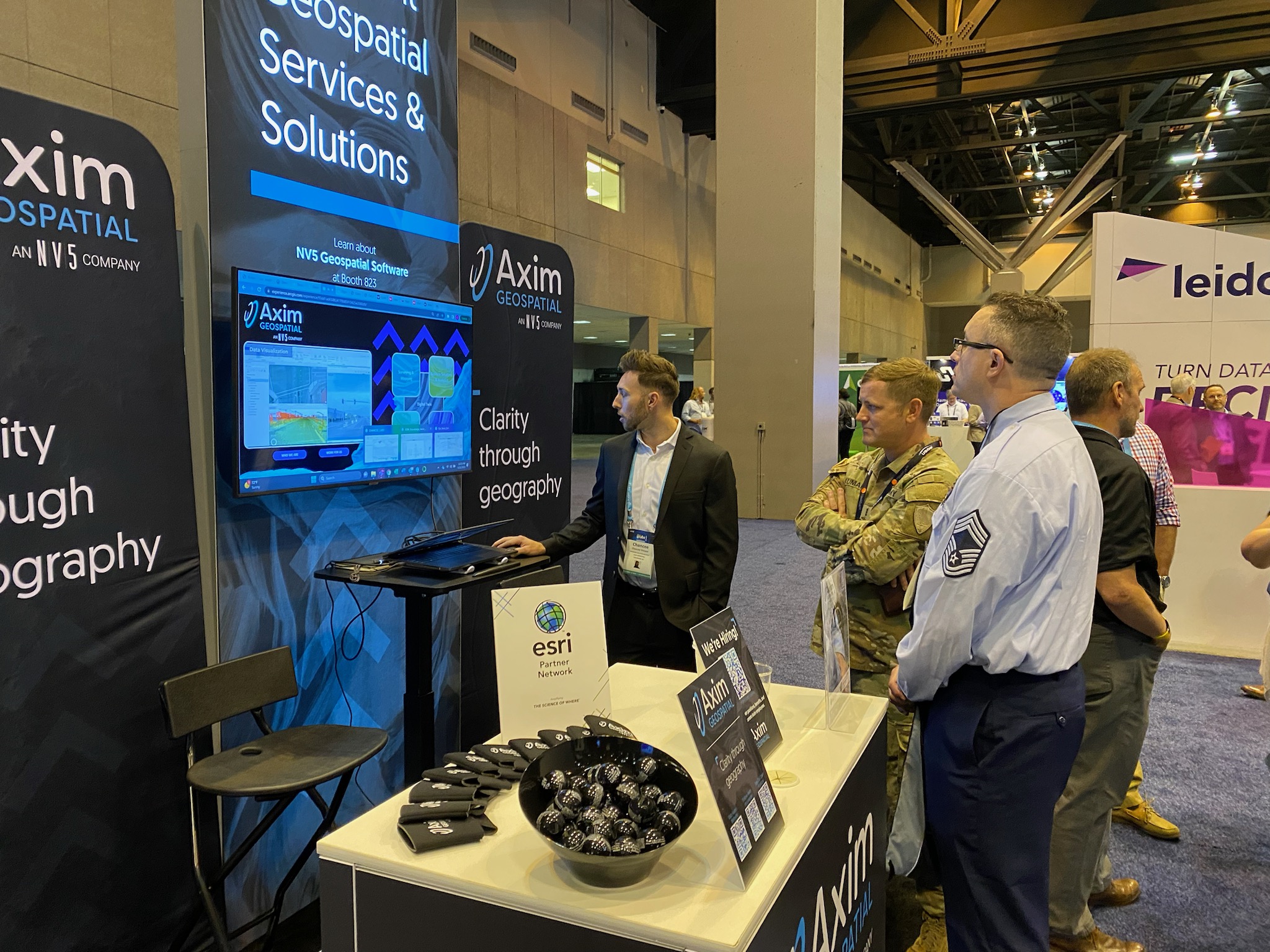
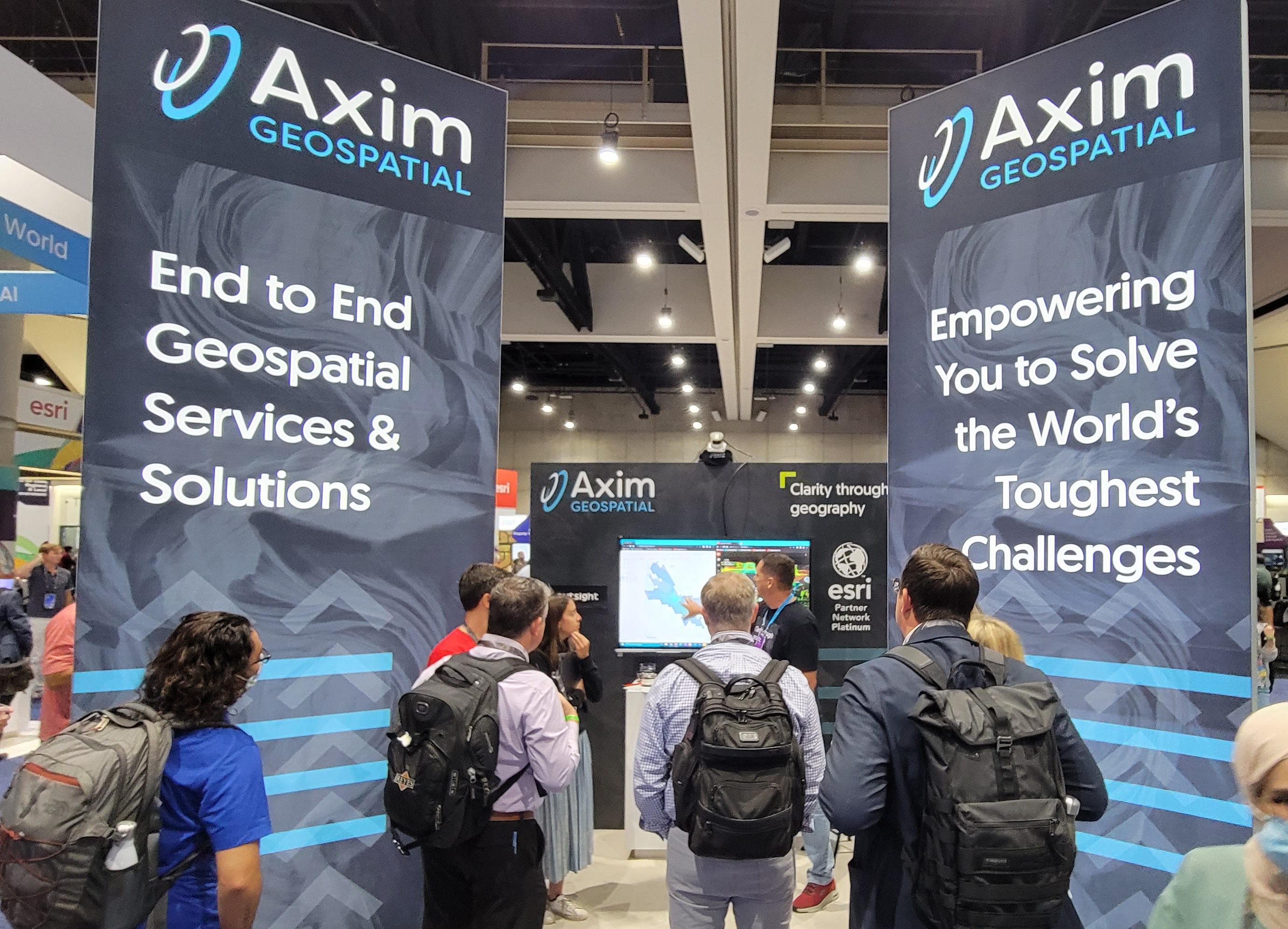
Patrick Murn | July 5, 2023
Attending the Esri User Conference? Visit Axim Geospatial in Booth 2019 at the San Diego Convention Center.
Read More
Tamara Dunbarr | April 20, 2023
Meet Axim's Carrie Aurit and learn about her journey in GIS.
Read More
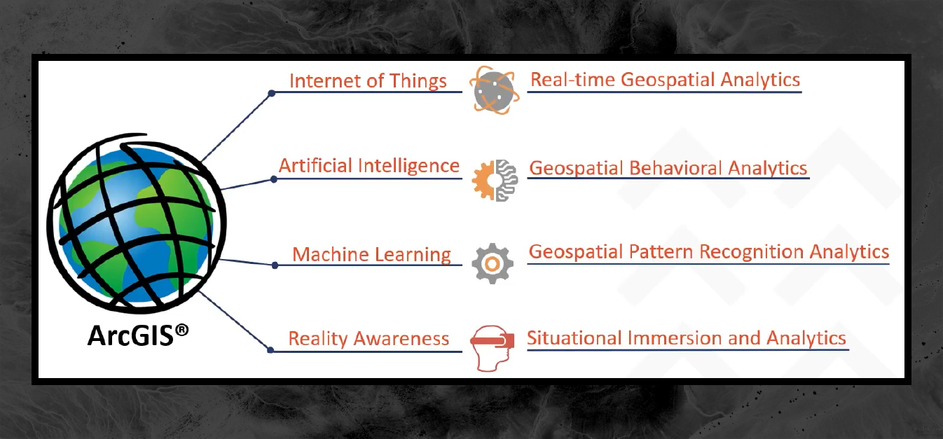
Steve Mulberry | April 10, 2023
Explore the ways ArcGIS can enhance integration, collaboration, and workflows.
Read More
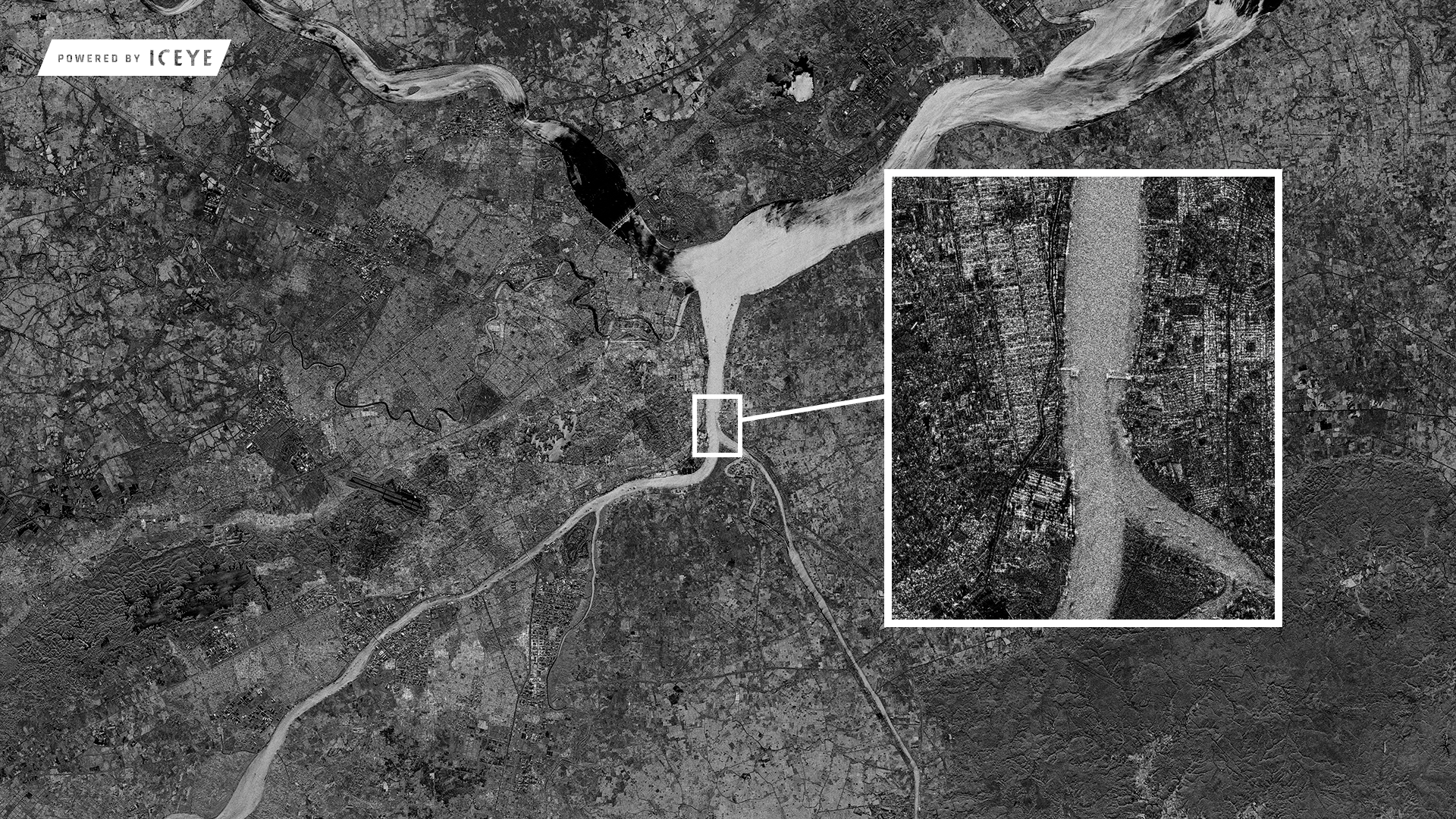
Chancee Vincent | March 30, 2023
Discover how SAR tech enhances military intel with all-weather surface data, GIS integration, and disaster relief applications in this blog.
Read More
Tobey Kane-Seitz | March 29, 2023
Improve your utility network modeling with ArcGIS attribute rules for manhole configuration. Create manhole channel & pipe connection points for full traceability.
Read More
Patrick Murn | March 10, 2023
Yesterday kicked off Day 3 of the 2023 Esri DevSummit. The Axim team has summarized what you might have missed - take a look!
Read More
Patrick Murn | March 9, 2023
Yesterday kicked off Day 2 of the 2023 Esri DevSummit. The Axim team has summarized what you might have missed - take a look!
Read More
Patrick Murn | March 8, 2023
Yesterday kicked off Day 1 of the 2023 Esri DevSummit. The Axim team has summarized what you might have missed - take a look!
Read More
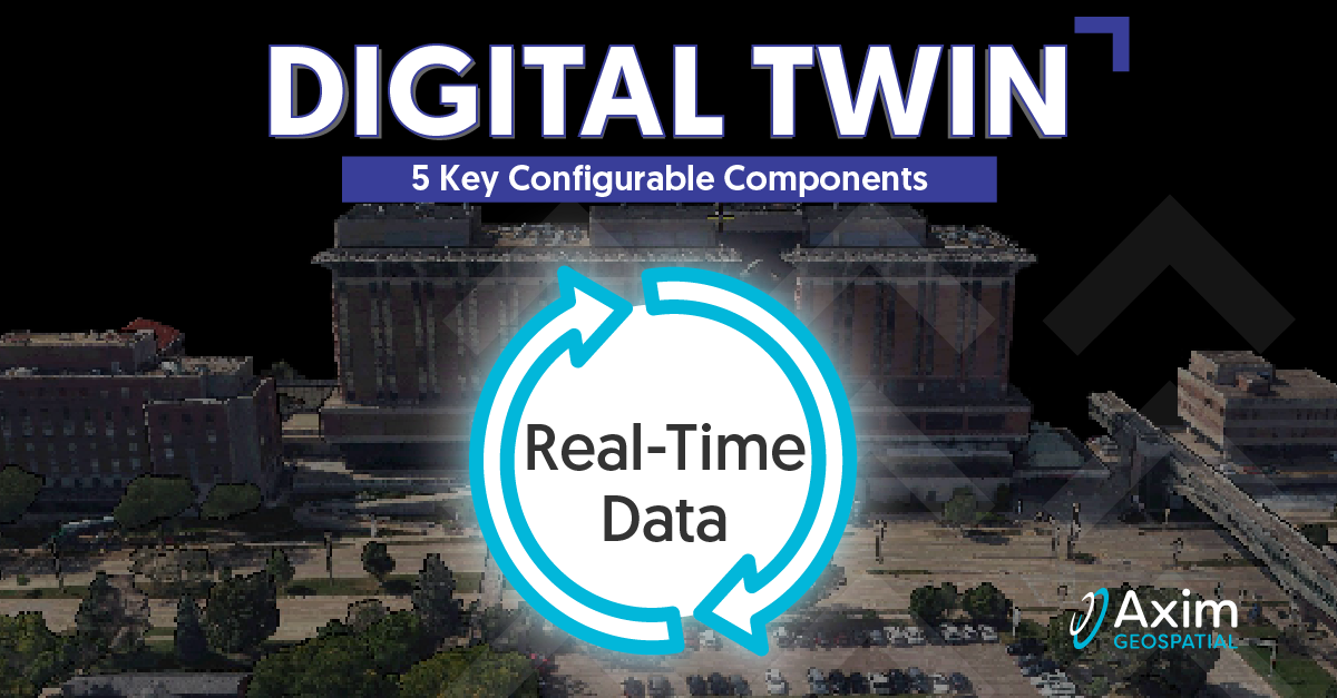
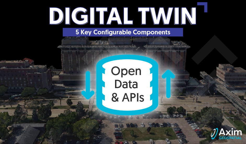
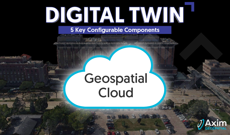
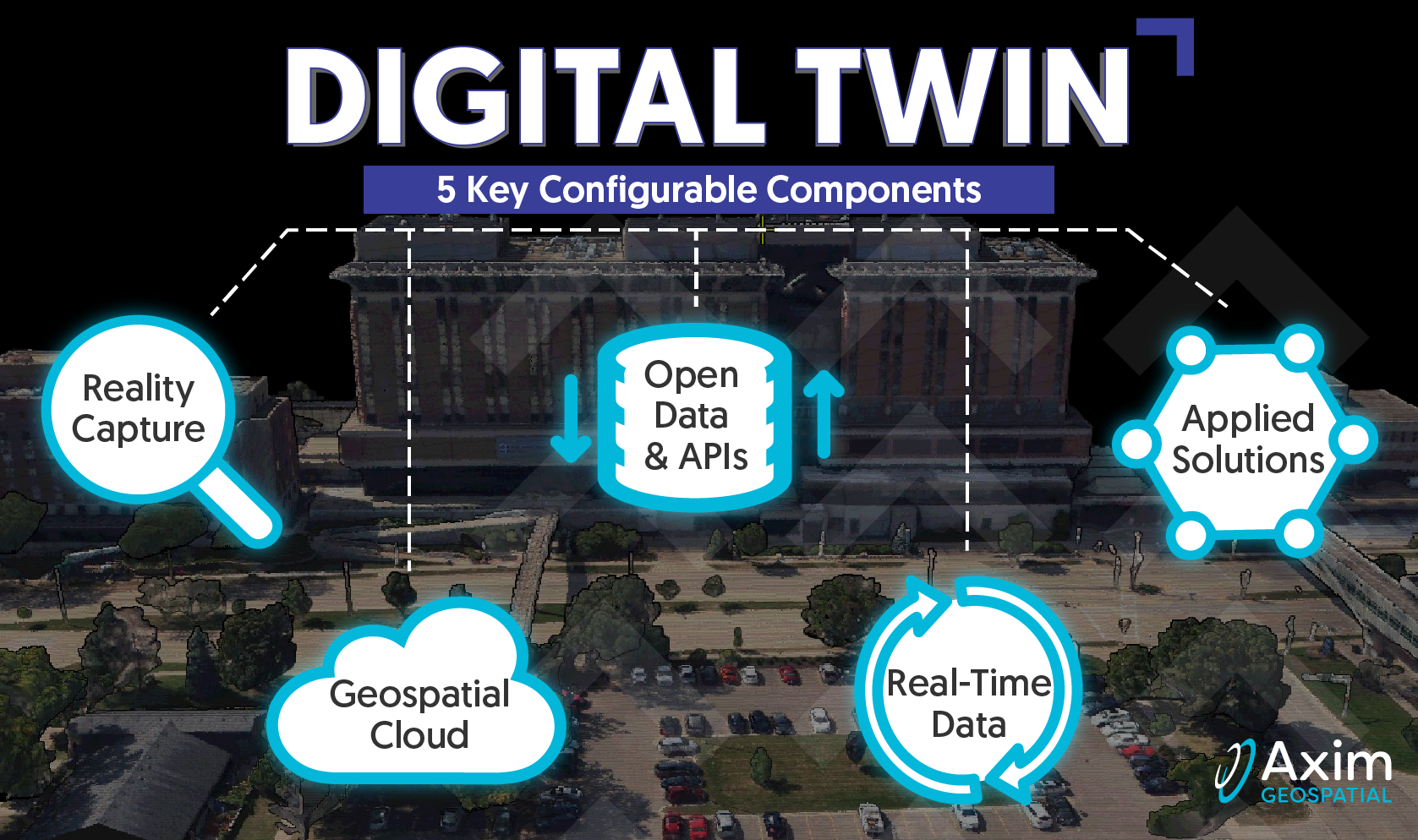
Pete Briere | February 27, 2023
Axim explores the roots of Digital Twins, as well as the core configurable components that comprise a Digital Twin.
Read More
Haley Jurecki | February 27, 2023
Meet Axim's Tamara Dunbarr and learn about her journey in GIS.
Read More
Pete Briere | February 14, 2023
Axim explores the roots of Digital Twins, as well as the core configurable components that comprise a Digital Twin.
Read More
Pete Briere | February 6, 2023
Axim explores the roots of Digital Twins, as well as the core configurable components that comprise a Digital Twin.
Read More
Pete Briere | January 24, 2023
Axim explores the roots of Digital Twins, as well as the core configurable components that comprise a Digital Twin.
Read More
Emily Mulligan | January 13, 2023
Meet Axim's Haley Jurecki and learn about her journey in GIS.
Read More
Patrick Murn | January 2, 2023
Axim is back on the road and coming to a location near you!
If you're traveling to any of the following events, we encourage you to connect with a member of our team.
Read More
Pete Briere | December 16, 2022
Axim explores the roots of Digital Twins, as well as the core configurable components that comprise a Digital Twin.
Read More