


The Challenge:
The Bay County Road Commission, located in Kawkawlin, MI, began with the following list of objectives:
- Retire an existing online complaint tracking software (for small projects) and an Access Database (for large projects); Combine into an Asset Management System to track both current projects and understand historical work
- Have an online application to track all work activities, allowing supervisors and crews to utilize and manage the system
- Easily answer questions regarding infrastructure
- Migrate to a new citizen engagement application to allow residents to report road issues and service requests through an easy-to-use online application
As a recipient of a Michigan Stormwater, Asset Management, and Wastewater (SAW) grant, Bay County Road Commission wanted to leverage a portion of the grant to improve their asset management strategy. Due to the time restrictions outlined in the grant, there was a compressed timeline for implementing an asset management solution.
Research and Solution:
The Bay County Road Commission maintained its asset inventory in a variety of GIS systems. When they began looking for an asset management system to track work, Cityworks AMS seemed like a natural fit. Combined with Esri’s Citizen Problem Reporter app, the two systems met all requirements of the Road Commissions’ objectives while leveraging their internal expertise and Esri licensing.
GISinc conducted an onsite Discovery Workshop to identify and outline the core configuration approach by identifying their main assets, work activities, types of service provided, inspections conducted, and reporting needs. The workshop also revealed which areas of configuration--with training and guidance--the road commission staff could easily execute themselves.
GISinc and the Bay County Road Commission collaborated to develop a work share partnership that allowed the Road Commission to stay within the limits of their grant funding source. To meet and support the grant funding and timeline, GISinc proposed an extensive work-share approach so the Bay County Road Commission team could execute the lion’s share of the work with the help of daily stand up calls, clear tasking guidance, deliverable due dates, and support from the GISinc team. This allowed the Road Commission Staff to extend the GISinc execution team and expedite the timeline.
After analyzing their needs, GISinc recommended the following integrations and components to provide Bay County Road Commission with a complete asset management system:
- Develop a configuration plan
During the onsite Discovery Workshop, GISinc identified and outlined the core configurations needed to successfully implement Cityworks for the Bay County Road Commission. GISinc worked with the Road Commission staff to identify their assets, work activities, types of services provided, and inspections conducted.
- Train and support Bay County Road Commission staff through Cityworks Configuration
GISinc conducted a 3-day Onsite Administrator Training course for the Bay County Road Commission to teach their two designated administrators. This approach of training and support allowed Bay County Road Commission (with no prior Cityworks experience) to use their technical staff to help support the configuration of Cityworks as a shared resource project. This unique approach gave the administrators hands-on experience in Cityworks Designer with an onsite GISinc resource providing guidance.
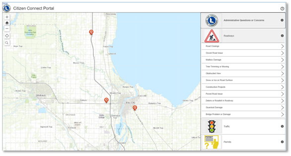
- Configure and publish a Citizen Problem Reporter app
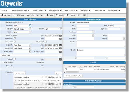
Leveraging their existing GIS knowledge and licensing, GISinc and the Bay County Road Commission deployed the Esri Citizen Problem Reporter app so residents can notify the Road Commission about issues and request a variety of services. The Citizen Problem Reporter app pushes new citizen requests into Cityworks through a simple integration. Field crews can use Cityworks to view, assign, and perform work against the requests. Automatic email notifications were configured to keep residents informed on the progress of their request.
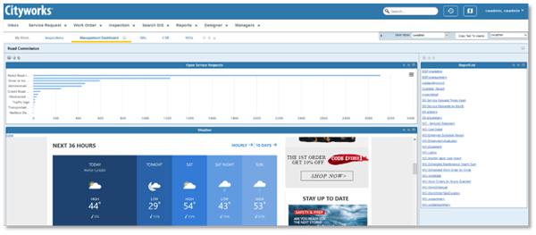
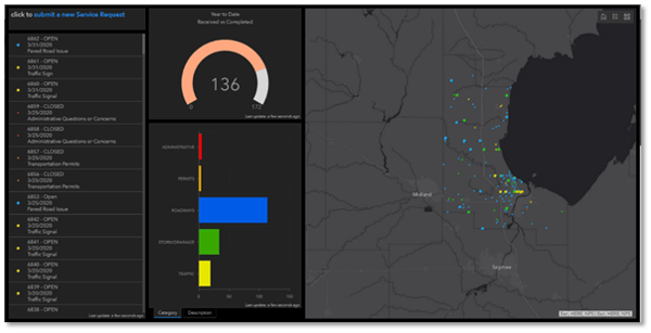
- Configure and publish an Operations Dashboard
An Esri Operations Dashboard was created by the GISinc team to summarize the number and types of service requests received by the Bay County Road Commission. The dashboard is automatically updated as new information is received and provides managers with current statistics and figures at a quick glance.
The Results:
The implementation of Cityworks Asset Management System provided Bay County Road Commission a new, robust system to track their work activities and operations programs. Cityworks allows them to leverage their GIS data and make informed decisions about investing in their assets. Utilizing the institutional knowledge and technical expertise of staff (with the support from GISinc), the Bay County Road Commission was able to heavily contribute to the project workload.
Utilizing their existing licensing for Esri products, the Bay County Road Commission and GISinc deployed additional applications that integrated with Cityworks to provide an easy-to-use online application for citizen service requests while leveraging the full functionality of Cityworks as a consolidated back-end application for field crews. Ultimately, the Bay County Road Commission was able to achieve internal objectives while satisfying the grant requirements and associated timeline.
Types of Software Used:
