


This article was written regarding work conducted under legacy company names: Continental Mapping, GISinc, or TSG Solutions. These three companies merged in January 2021 to form a new geospatial leader Axim Geospatial.
Overview
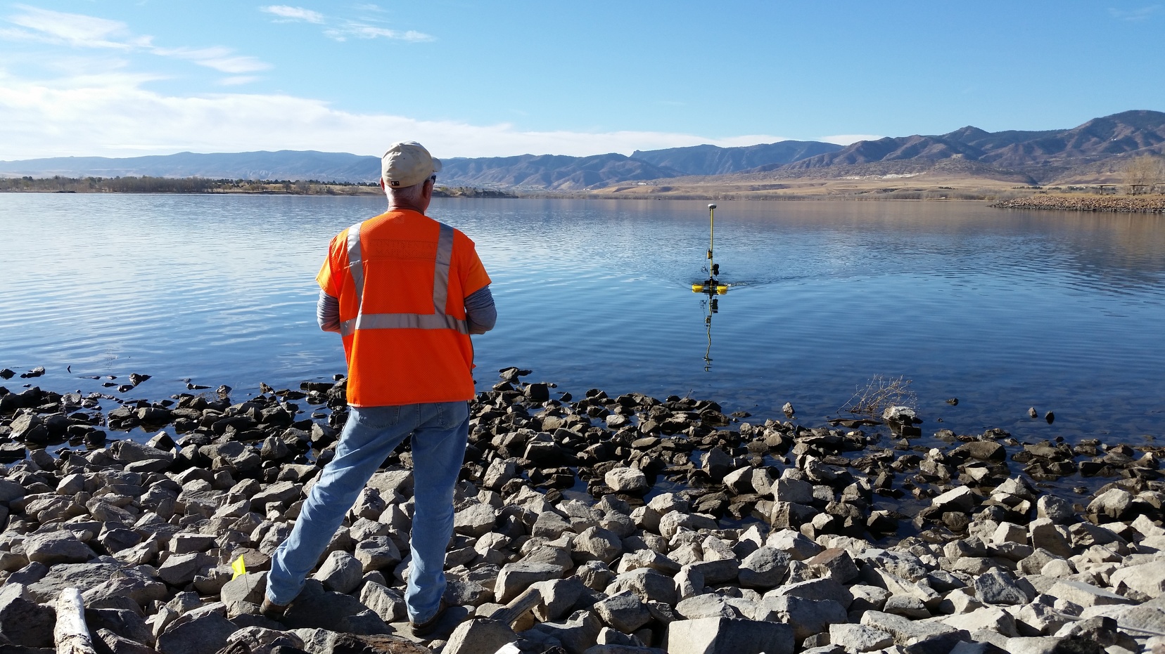
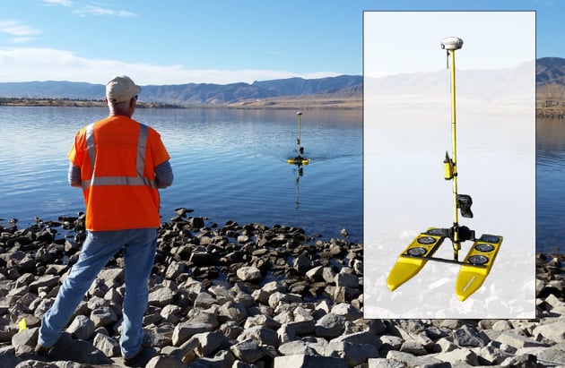
Axim Geospatial performed planimetric mapping via aerial imagery and bathymetric survey using a semi-autonomous hydrographic survey system within the Chatfield Reservoir in the eponymous Colorado state park to support additional water storage and conservation in the reservoir.
For over forty years, the Chatfield Reservoir, located in Chatfield State
Park in the southwest suburbs of Denver, Colorado, has provided Coloradans with a water resource essential to agriculture, recreation, and the state’s livelihood. However, growing water demand from agriculture and municipalities in Colorado’s northeast region forced conservationists to assess their resources and plan for the future. This sparked the Chatfield Water Reallocation Project, a coalescence of multiple government agencies and engineering partners to provide a solution. The U.S. Army Corps of Engineers (USACE) concluded that 20,600-acre feet of water storage (or an additional 12 feet of surface water level) could be added to the reservoir’s water storage while maintaining its flood control capabilities. USACE, in coordination with The Chatfield Reservoir Mitigation Company (CRMC) and SmithGroupJJR, Axim worked to turn this project into a reality.
Axim supported design efforts by collecting, producing, and delivering bathymetric and planimetric mapping data in the Chatfield Reservoir. Axim was chosen because of the company’s past performance in littoral environments, experience with conservation efforts, speed of deployment, and end-to-end support. The data Axim delivered supported the project team’s planning, engineering, and consensus-building efforts.
.jpg?width=496&name=New%20folder%20(1).jpg)
The proposed increase in water level required detailed mapping of existing conditions to support engineering, particularly near public recreational areas. Axim performed aerial photogrammetric mapping of the reservoir’s marina, facilities, and utilities in an initial phase of the project. The detailed mapping of all facilities and utilities assisted designers in assessing design alternatives for the public facilities.
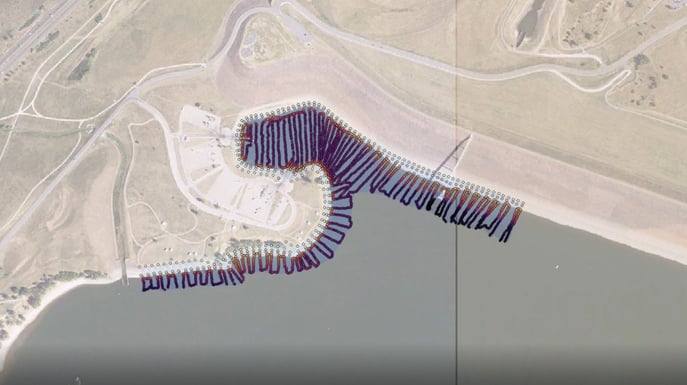 Bathymetric data shows where the South Platte River feeds into the reservoir, as well as the public boat launch.

