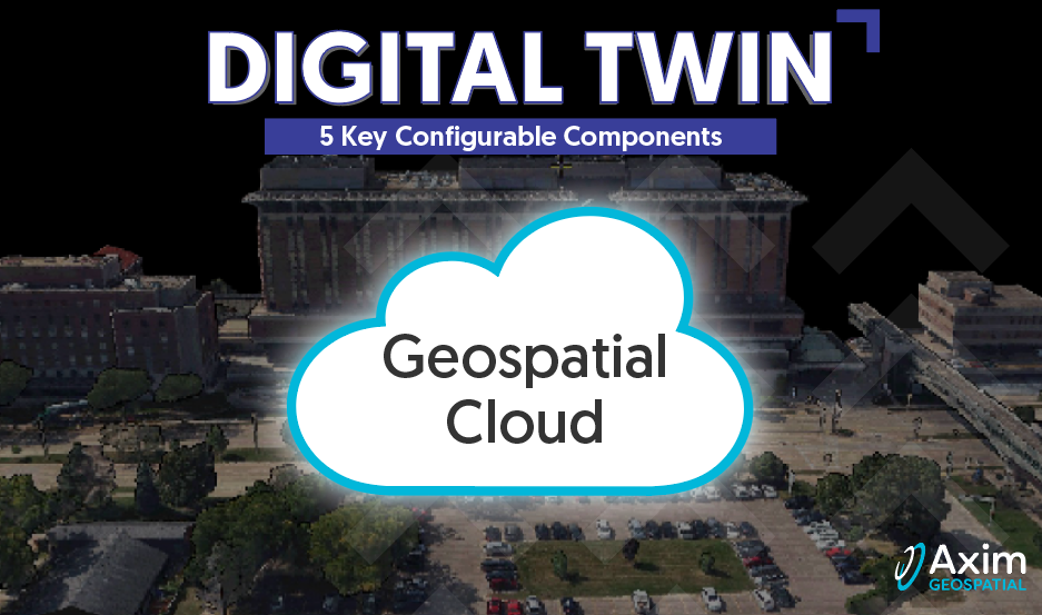
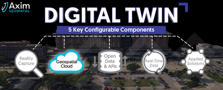
In the third article of our series on digital twins, we explore geospatial cloud services as a key configurable digital twin component. Check out our second article where we explore the reality capture component.
Does your organization rely on cloud services to support mission critical activities? Given the ubiquitous influence of the cloud across industries perhaps the better question is how well prepared is your organization to support the same mission if cloud services became unavailable? In a few short decades we have become as accustomed to associating a cloud with the internet as with water vapor in the atmosphere. The most significant link, rather than shape, content, or definition, is rather how reliant our past and current communities have been on clouds throughout history. A century ago, farming was a primary occupation in America and these farmers were expert watchers of the skies. Today, many of us are disconnected from our farming roots however our food, safety and commerce continue to be linked to the clouds.

Cloud computing, and associated cloud services, have been in play in some form since the 1960’s although the terms have only become commonplace during the last 20 years. Today cloud is used loosely to describe the computing resources comprising the internet, while cloud services are those services provided over the internet enabling access to applications and data without the need for all the corresponding on-premises infrastructure. Cloud services are often deployed in the following models: Software-as-a-Service (SaaS); Platform-as-a-Service (PaaS); and/or Infrastructure-as-a-Service (IaaS). Geospatial cloud services enable end users to leverage large and dispersed spatial datasets, powerful software and computing resources, and automated tools to convert complex systems into timely insights.
Today we are seeing infrastructure under increasing threat. Attacks at electrical substations in Washington state cut power to thousands just weeks after substations in North Carolina were disabled. Our physical assets and their digital twin counterparts are part of a connected ecosystem enabled by geospatial cloud services. The adoption of cloud services in the energy sector demonstrates the benefits of organization, management, and responsiveness through increased access to asset and infrastructure information. The associated security risks for continuity of operations are also elevated as both physical and digital systems must be safeguarded to maintain our nations critical infrastructure. Axim empowers our clients to solve the toughest security problems through a better understanding of their world. This is accomplished through world-class design followed-by rigorous implementation and adaptation to address dynamic risk profiles.
 Cloud hosted data and cloud managed services allow for improved scalability, redundancy, security, and access.
Within the geospatial community, Esri users of ArcGIS Online have experienced a transition to the SaaS model in recent years. The Esri architecture continues to evolve and scale, with PaaS and IaaS capabilities increasing available and integrated into a geospatial user cloud service solution. Axim provides cloud services and digital twin security solutions by helping organizations design, implement and sustain a system configured to the mission. Axim’s proprietary applications, the Esri geospatial cloud, the Cityworks cloud-based asset management solution, and other scalable SaaS applications have all been successfully deployed by Axim separately, and together, for end users across the globe.
Perhaps your organization has an existing on-premises solution you want to maintain, while realizing additional flexibility and resiliency benefits offered by a cloud services deployment. With stay-at-home orders in the early days of Covid-19, many found new benefits in the cloud related to remote work, facility cost management, flexible pricing models, data dissemination, and security oversight.
Where a migration to the cloud is the goal, several paths may be considered ranging from the relatively light effort of moving the existing system from on-premise to a cloud platform, through rearchitecting a solution while leveraging all the native cloud services, headless computing, adopting microservices, and containerization where possible.
.png?width=357&height=334&name=MicrosoftTeams-image%20(19).png)
The growing adoption of geospatial cloud services is creating opportunities for more capable and collaborative digital twin solutions. Whether you are involved in design/build, emergency response, managing critical infrastructure, or looking for a more collaborative environment for your workforce, geospatial cloud services and digital twins are being adopted by organizations in all industries. If you are ready to get started with geospatial cloud services, click the "Schedule a Meeting" button below.
Our series on digital twins will continue as we launch into open data and APIs.
Capgemini Research Institute, Digital Twins survey, September–October 2021
 Axim is an Amazon AWS Select Tier Services Partner, maintains the Esri ArcGIS Cloud Services Specialty Designation, and has supported many clients on the Microsoft Azure cloud platform.
Are you ready to learn more about how to leverage and implement Digital Twin components to solve your business problems?