Cara Nolte | November 13, 2023
Optimize GIS with ArcGIS Monitor 2023. Proactive health, performance, and Managed Services support.
Read More
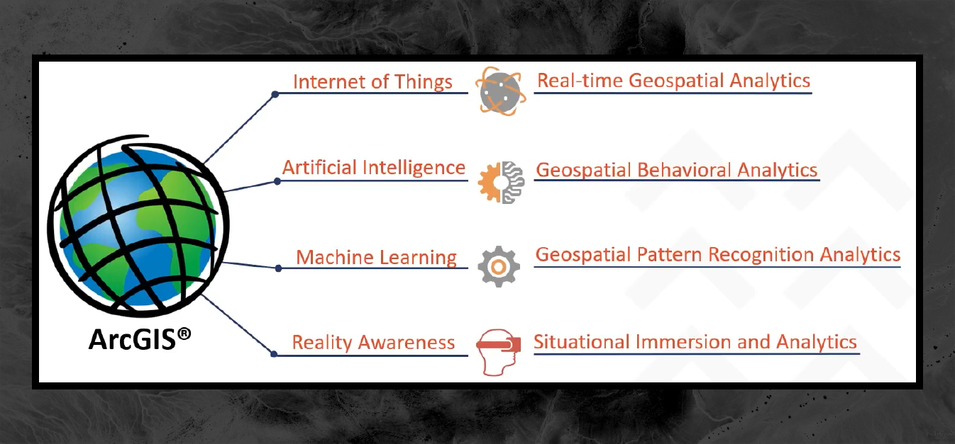
Chancee Vincent | July 7, 2023
Uncover hidden connections with Graph Databases & ArcGIS Knowledge. Explore transformative technology, uncover patterns, and make informed decisions.
Read More
Steve Mulberry | April 10, 2023
Explore the ways ArcGIS can enhance integration, collaboration, and workflows.
Read More
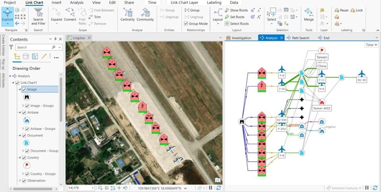
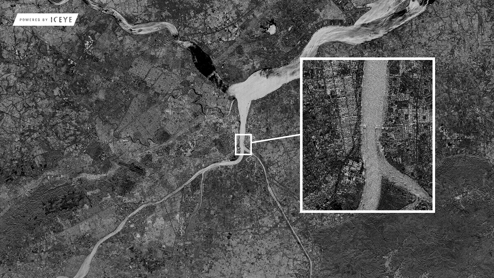
Chancee Vincent | March 30, 2023
Discover how SAR tech enhances military intel with all-weather surface data, GIS integration, and disaster relief applications in this blog.
Read More
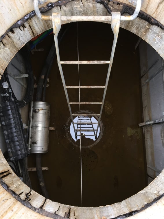
Tobey Kane-Seitz | March 29, 2023
Improve your utility network modeling with ArcGIS attribute rules for manhole configuration. Create manhole channel & pipe connection points for full traceability.
Read More
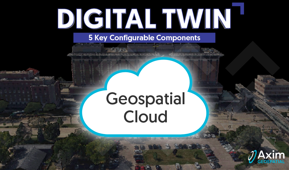
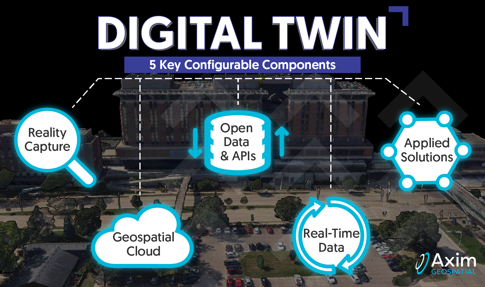
Pete Briere | February 27, 2023
Axim explores the roots of Digital Twins, as well as the core configurable components that comprise a Digital Twin.
Read More
Pete Briere | February 14, 2023
Axim explores the roots of Digital Twins, as well as the core configurable components that comprise a Digital Twin.
Read More
Pete Briere | February 6, 2023
Axim explores the roots of Digital Twins, as well as the core configurable components that comprise a Digital Twin.
Read More
Pete Briere | January 24, 2023
Axim explores the roots of Digital Twins, as well as the core configurable components that comprise a Digital Twin.
Read More
Pete Briere | December 16, 2022
Axim explores the roots of Digital Twins, as well as the core configurable components that comprise a Digital Twin.
Read More
Kevin Stewart | October 5, 2022
Axim explores the roots of Digital Twins, as well as the core configurable components that comprise a Digital Twin.
Read More
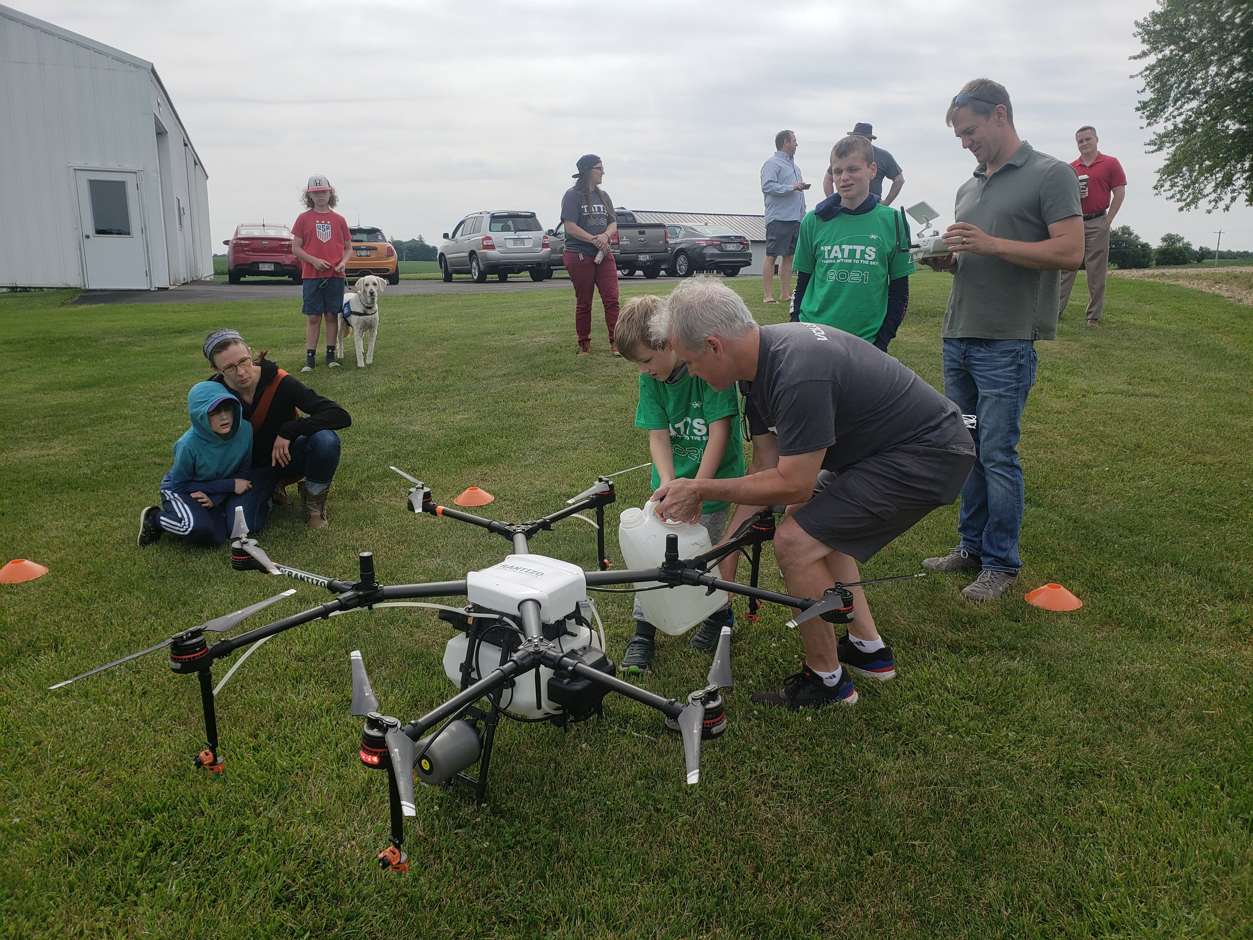
Dan Frye | April 20, 2022
Taking Autism to the Sky (TATTS) is a volunteer-run, award-winning, non-profit organization founded by Axim Geospatial's VP of Sales and Marketing, Paul Braun. Founded in 2012 in Maidson, WI, TATTS leverages drones to develop social and employment skills for autistic individuals.
Read More
Patrick Murn | January 5, 2022
Axim Geospatial’s mission is to use our expertise to provide clarity and solutions to help our clients solve the world’s toughest problems.
Read More
Patrick Murn | November 23, 2020
Kevin Hope reflects on the geospatial industry, from his history to the future of GIS.
Read More
Paul Braun | July 24, 2020
We break down all things cartography at GISinc and Continental Mapping.
Read More
Patrick Murn | March 4, 2019
OpenDRIVE is the basemapping program that’s pushing autonomous vehicles into the future of efficiency.
Read More