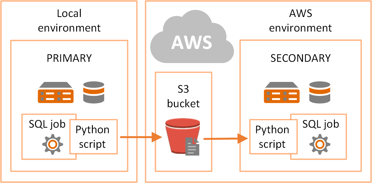
This article was written regarding work conducted under legacy company names: Continental Mapping, GISinc, or TSG Solutions. These three companies merged in January 2021 to form a new geospatial leader Axim Geospatial.
Challenge:
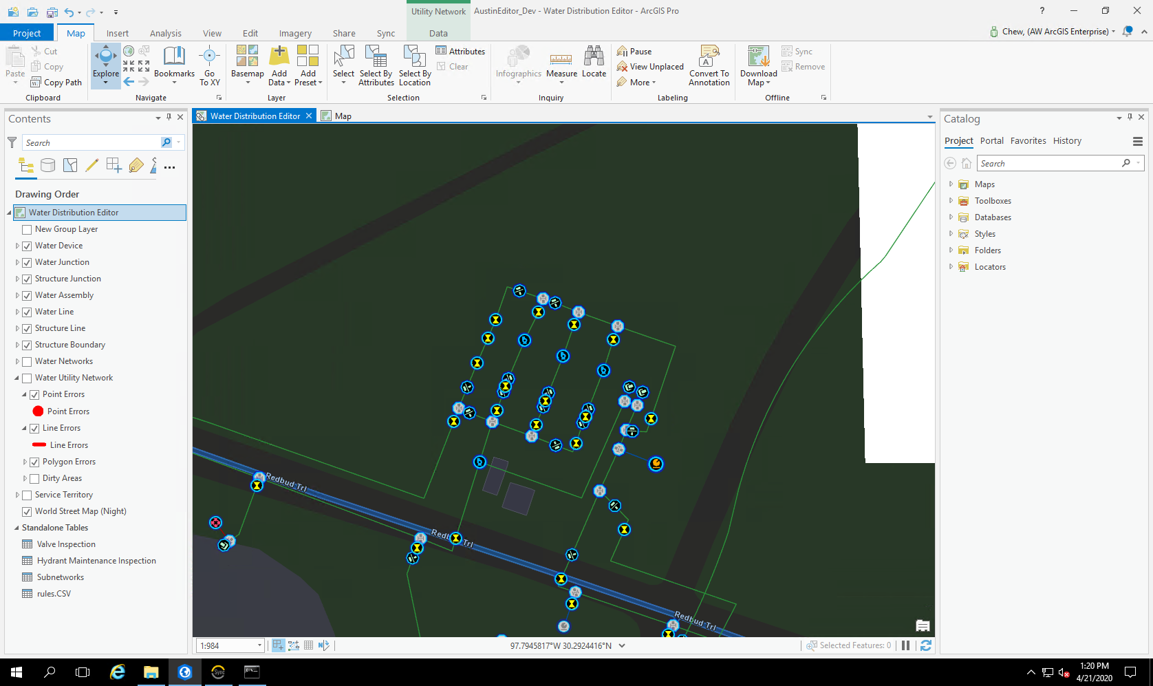
Austin Water in Austin, Texas serves over 1 million customers in more than a 548 square-mile service area. The Austin Water Geometric Network data model had been in use since around 2002, predating ArcGIS for Water (AG4W). Austin Water expressed the desire to more closely align with Esri’s current standard industry solutions, specifically with the recently released ArcGIS Utility Network Management Extension.