Kelly Bigley | August 31, 2021
Axim Geospatial's support blocks offer clients a flexible, managed block of time that they can tap into for all sorts of purposes when they need any assistance.
Read More
Chris Collier | May 4, 2021
Cityworks Analytics and Cityworks Operational Insights are both great options for routing data into Insights for ArcGIS for visualizing and adding spatial context to assets. Learn more about each in this article.
Read More
Kelly Farley | May 3, 2021
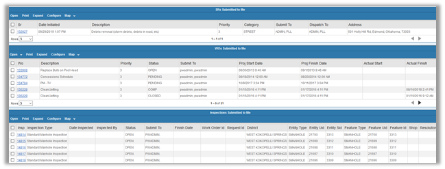
Does your organization use Cityworks? We'd like to share an alternative workflow to consider if you are a treatment plant operator. You may be accustomed to the standard process listed below, but there is an alternative process we think you should know about. Continue reading to find out what I mean.
Read More
Chris Collier | April 30, 2021
There are countless ways that Cityworks can be tailored to your organization. Whether you use Cityworks AMS, Cityworks PLL, or both, we're confident Cityworks can track the maintenance/cost of your infrastructure, and organize permits, plans, and licenses through innovative workflows to help you stay organized and work smarter.
Read More
Carrie Harapat | April 26, 2021
My job as a Solutions Engineer is to support our Cityworks users and find solutions to solve their unique challenges. Safe Software's FME is the perfect tool to help me accomplish this!
Read More
Kelly Bigley | April 9, 2021
Esri DevSummit 2021 has ended and we've put together a Day 3 and event final thoughts in the following VLOG. Find out which recordings you should watch!
Read More
Steve Mulberry | April 8, 2021
Day 2 of Esri 2021 is in the books! Did you miss it? For your convenience, we've summarized some of the high points in the following VLOG.
Read More
Kelly Bigley | April 7, 2021
Yesterday kicked off Day 1 of the 2021 Esri DevSummit. The GISinc has summarized what you might have missed - take a look!
Read More
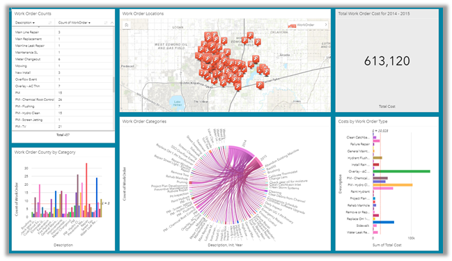
Kelly Farley | March 18, 2021
Cityworks and Esri provide very powerful tools to visualize your Cityworks data. They can be used independently, or in conjunction with each other to analyze work activities and associated costs.
Read More
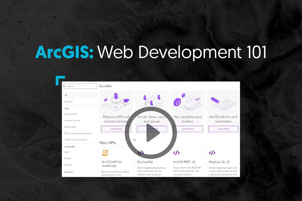
Kelly Bigley | March 10, 2021
As a new web developer, how do you progress your tutorial code into an application that implements a modern web application architecture? This video is a quick dive into connecting the dots.
Read More
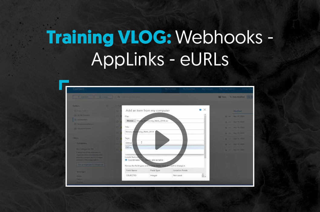
Steve Mulberry | February 24, 2021
Learn how to use Webhooks, AppLinks, and eURLs. We will begin with defining what they are and why you want to know about them. Then we'll move on to share insights and examples that demonstrate advanced and innovative concepts. Join us!
Read More
Patrick Murn | November 23, 2020
Kevin Hope reflects on the geospatial industry, from his history to the future of GIS.
Read More
Shannon Prather | November 10, 2020
Over the past few months, GISinc experts have released a few short Video Blogs (VLOGs) to help Esri Customers who are interested in ArcGIS Enterprise Cloud Tools, Migrations, Business Continuity, or Desktop in the Cloud. As a bonus, we added in a discussion of Monitoring the Health of ArcGIS Enterprise.
Read More
Paul Braun | July 24, 2020
We break down all things cartography at GISinc and Continental Mapping.
Read More
Patrick Murn | June 24, 2020
A cornerstone to effective asset management is having an understanding of what assets you have and where they're located. A geospatial asset inventory is a basis for that understanding which also feeds all sorts of other uses from emergency management, to compliance, to economic development.
Read More
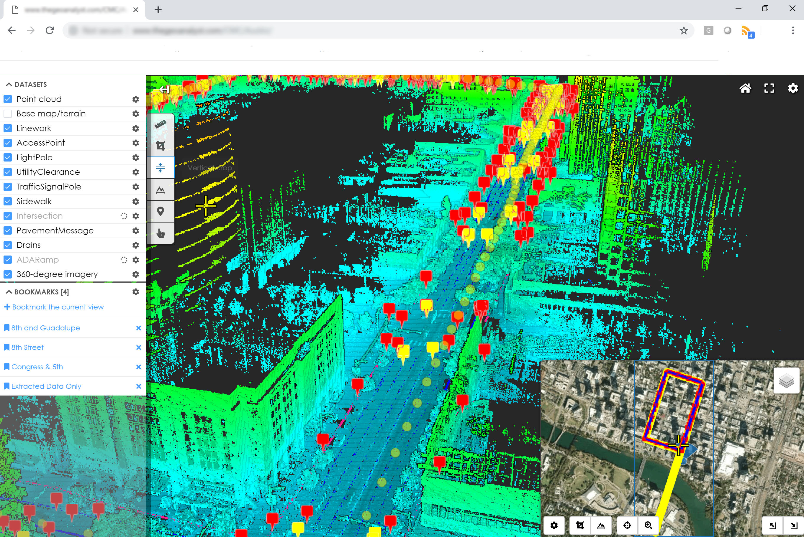
Kent Williams | June 17, 2020
Server monitoring can take the form of a set of simple utilities that tell you the basic health of your system, it can be a comprehensive GIS-server-specific suite of tools with reporting and advanced notification, or somewhere in between.
Read More
Rachel Maynard | June 11, 2020
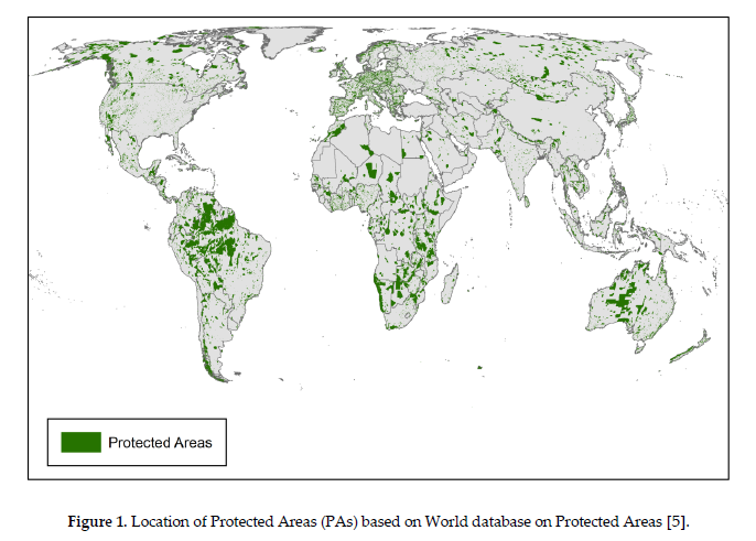
Using global land cover data, raster analysis, GIS tools, and data visualization, this research answers the question: What is threatening global forests?
Read More
Shannon Prather | May 30, 2020
This year GISinc Utility Network experts have released a few short Video Blogs (VLOGs) to help Esri Customers who are interested in Esri's ArcGIS Utility Network Management solution, project approaches, containment associations, isolation tracing, and more.
Read More
Shannon Prather | May 27, 2020
Listen to Steve Mulberry and Tony Urquidi explain how ArcGIS Desktop can run in the cloud alongside ArcGIS Enterprise.
Read More
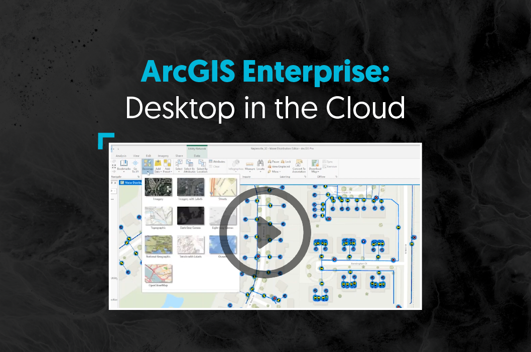
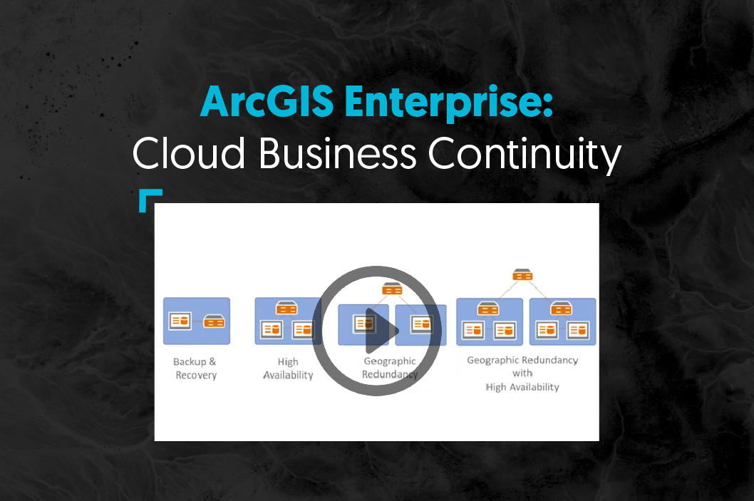
Shannon Prather | May 27, 2020
Axim Geospatial's Steve Mulberry and Solution Engineer Tony Urquidi talk about the Cloud Business Continuity for ArcGIS Enterprise.
Read More