


This article was written regarding work conducted under legacy company names: Continental Mapping, GISinc, or TSG Solutions. These three companies merged in January 2021 to form a new geospatial leader Axim Geospatial.
This article was written regarding work conducted under legacy company names: Continental Mapping, GISinc, or TSG Solutions. These three companies merged in January 2021 to form a new geospatial leader Axim Geospatial.


Patrick Murn | 2021
Renewable energy developers in Texas used aerial lidar and ortho imagery to understand conditions for future solar farm engineering projects.

Patrick Murn | 2020
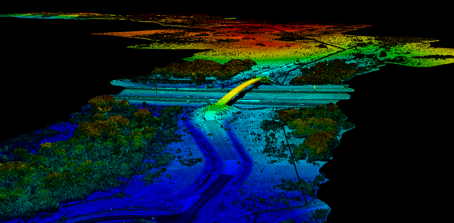
MnDOT planned the re-design and construction of the I-35/Highway 53 interchange with survey-grade mobile data collected by [Axim Geospatial].
Patrick Murn | 2020
USACE - Omaha District utilized aerial lidar to monitor levee conditions along the Missouri River in order to mitigate flood damage across communities.
Patrick Murn | 2020
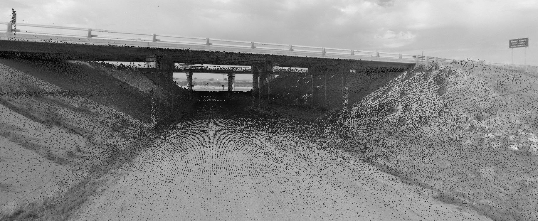
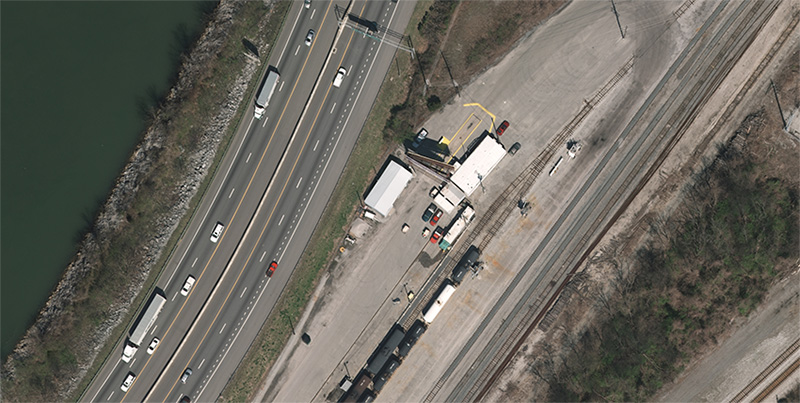
INDOT collected over 32,000 clearance measurements across their highways in order to meet federal reporting requirements and understand bridge conditions.
Patrick Murn | 2019
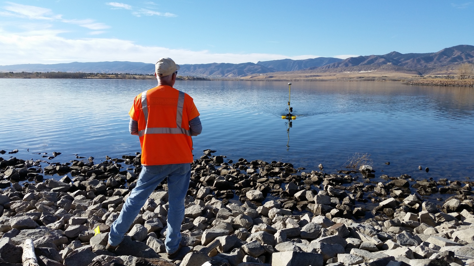
The Chatfield Reservoir in Colorado was mapped with aerial imagery and bathymetric survey to support additional water storage and reallocation efforts.
Patrick Murn | 2018
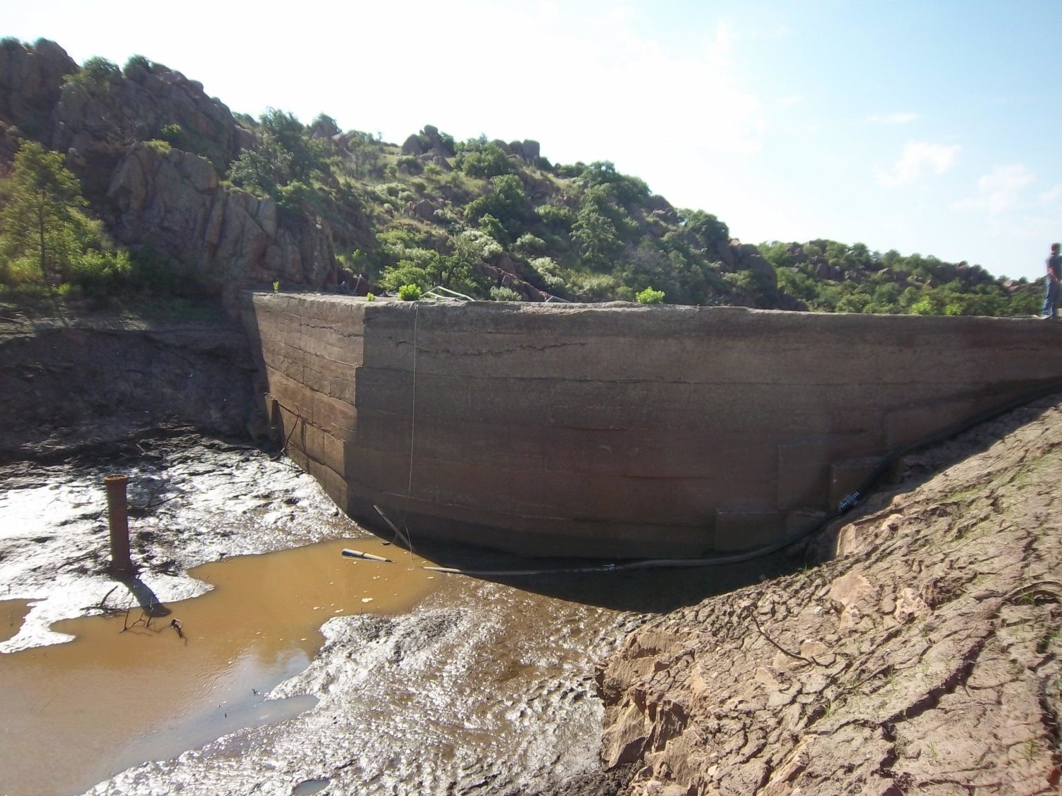
USACE Tulsa District supported dam assessment and soil erosion studies with the help of topographic and planimetric mapping data.

Patrick Murn | 2017
A 63,000 panel solar farm was designed and constructed in Fort Hood, Texas with the help of data collected by [Axim Geospatial].
Patrick Murn | 2017
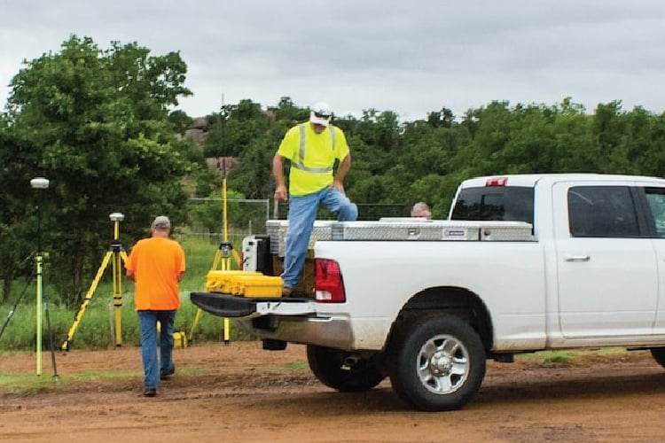
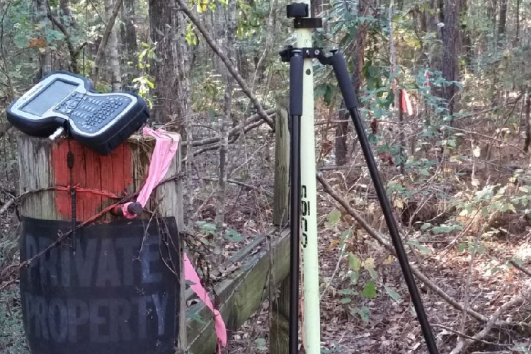
Fort Sill in Oklahoma performed a boundary survey with the help of data collected by Continental Mapping Consultants.
Patrick Murn | 2017
A utility client updated its GIS database for asset inventory and regulatory reasons with mobile lidar and asset inventory data.
Patrick Murn | 2017
Fort Polk in Louisiana expanded it's base size with the help of boundary survey data collected by [Axim Geospatial].
Patrick Murn | 2017
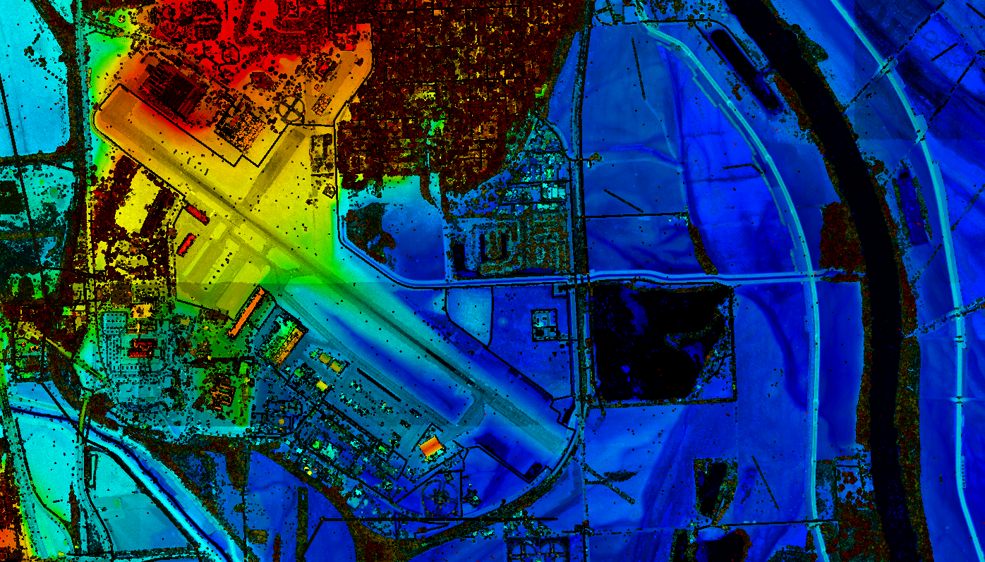
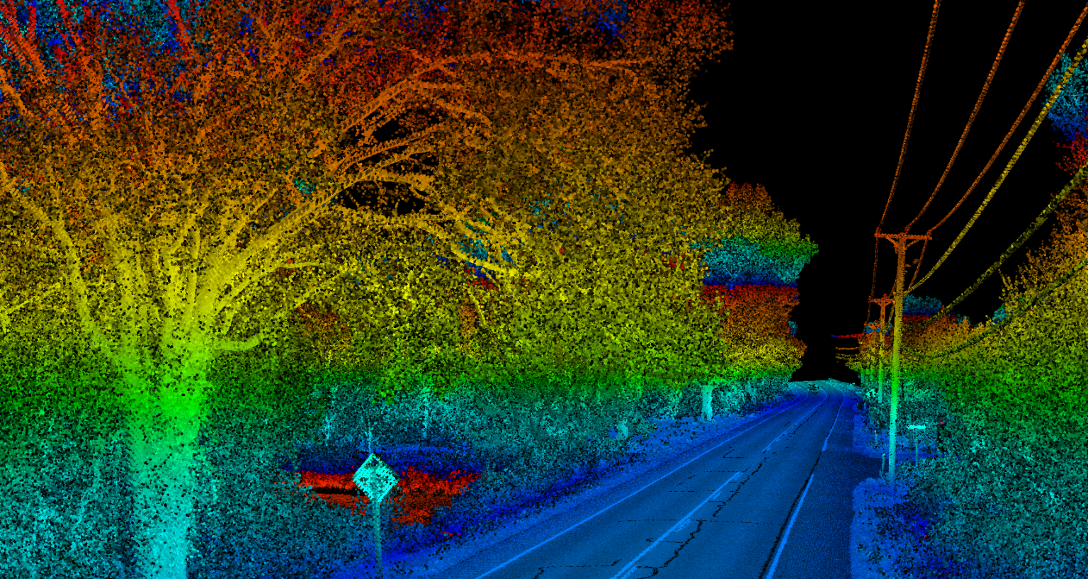
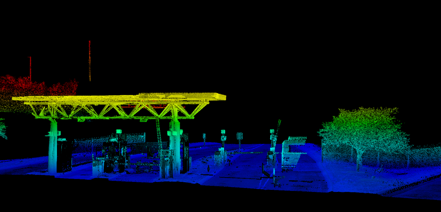
TDOT utilized lidar data to assess and update existing highway infrastructure around the Nashville International Airport.
Patrick Murn | 2017
TDOT utilized mobile and aerial imagery and lidar to assess the busy Moccasin Bend corridor with the help of Axim Geospatial.
Patrick Murn | 2017
Fort Hood in Texas completed a pavement analysis with the help of photogrammetry and aerial lidar data.
Patrick Murn | 2017
Antrim County, MI developed hydrographic modeling for the FEMA Risk Map program with the help of aerial lidar data.

Patrick Murn | 2016
USACE utilized imagery, lidar, surveys, and photogrammetric mapping to help monitor aging infrastructure at the Table Rock Lake Dam.
Patrick Murn | 2016
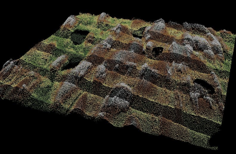
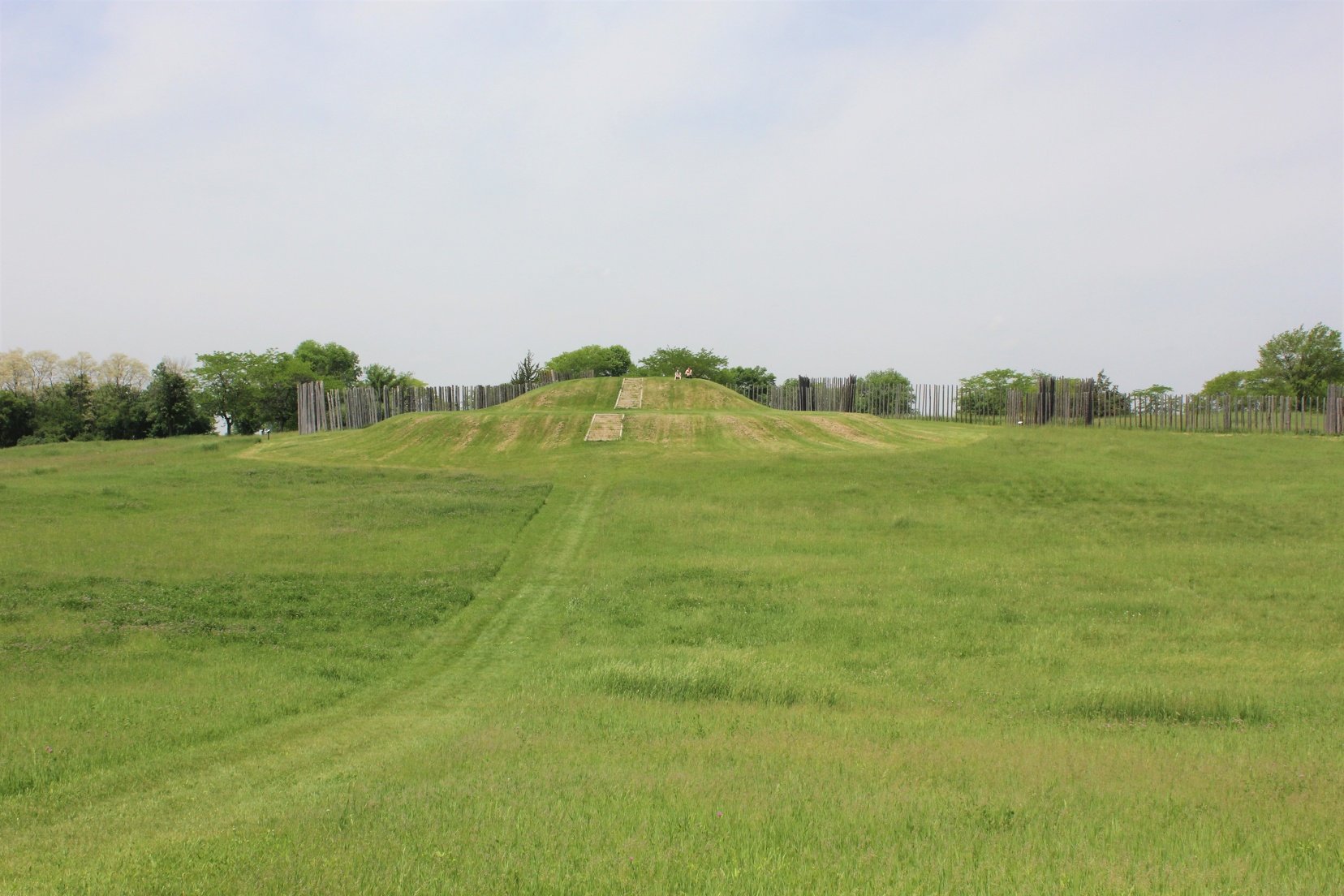
Wisconsin DNR developed a 3D rendering of an ancient Middle-Mississippian village at Aztalan State Park with the help of aerial lidar data.

Patrick Murn | 2015
WisDOT changed US-41's designation from highway to interstate with the help of imagery and data collected by Axim Geospatial.
